top of page

Autonomous Symmetry
Preparing Atlanta for Self-Driving Mobility
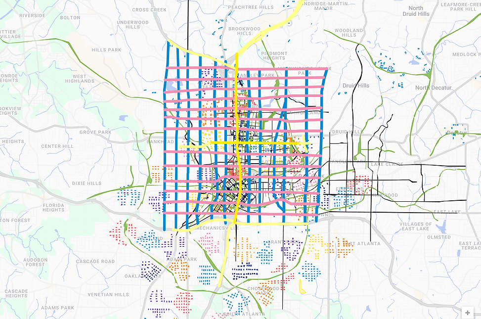
Autonomous Grid Framework Example - Downtown Atlanta
-
Blue Lines + Pink Lines - Autonomous Grid Framework
-
Yellow Lines - Proposed First Elevated Routes
-
Green Lines - Linear Park Trails
-
Black Lines - Pedestrian paths, but also capable of handling moving trucks and cranes, etc.
-
Small Colorful Boxes - Clusters of where 2000 potential tall buildings could eventually go in more expansive, high velocity L3-L4 systems
Atlanta's Potential Near-Term Autonomous Grid Framework is also available:
bottom of page